
Late Morning/Midday, Thursday, September 7, 2023, Lithia, Florida
Hey, there, everyone.
Well, here we are again, on a Thursday that, thanks to the three-day Labor Day weekend, feels oddly like a Wednesday. A hot, sticky, subtropical Florida Wednesday, with a dollop of yet more “Will a hurricane hit Florida?” anxiety added to the mix.
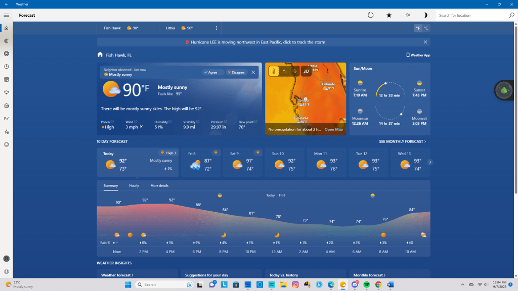
Currently, the temperature – outside – is 88°F/31°C under mostly sunny conditions. With humidity at 58% and a weak northerly 1 MPH/2 KMH breeze, the heat index is 95°F/35°C. Today’s forecast calls for mostly sunny skies and a high of 93°F/33°C.
Summer, apparently, wants to keep its death grip on Florida a bit longer, I guess.
As for Hurricane Lee, let’s see what the National Hurricane Center in Miami has to say about that particular cyclone:
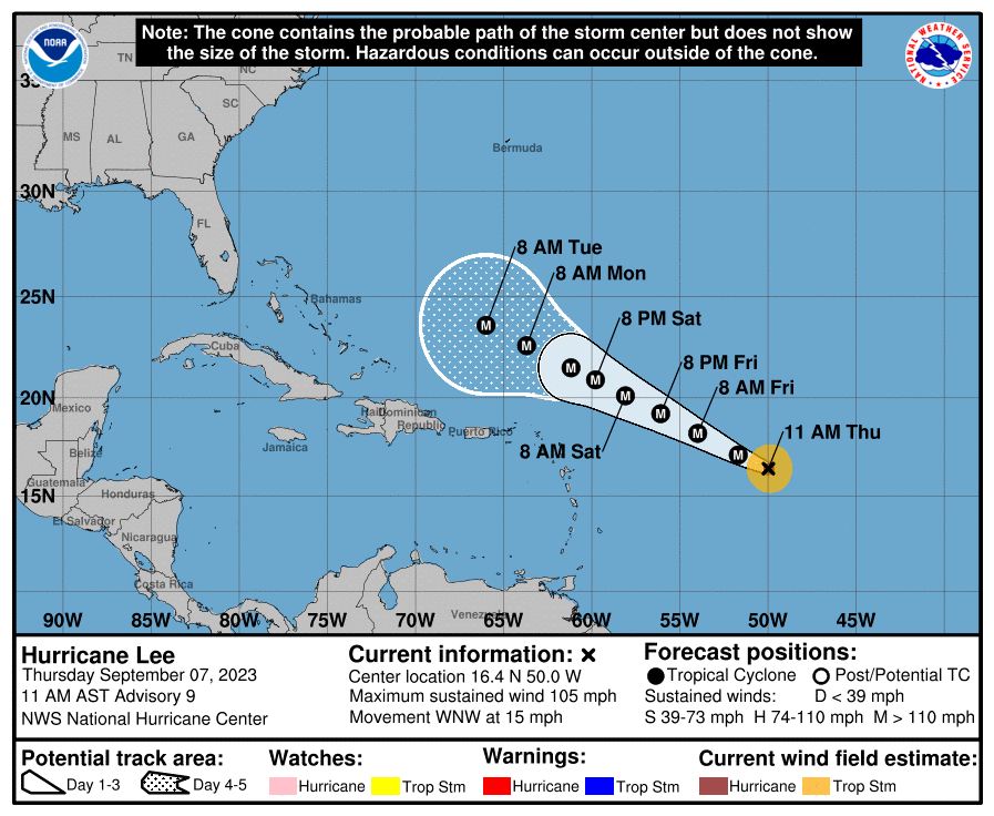
BULLETIN
Hurricane Lee Advisory Number 9
NWS National Hurricane Center Miami FL AL132023
1100 AM AST Thu Sep 07 2023
…LEE RAPIDLY STRENGTHENING…
…LARGE SWELLS LIKELY TO REACH THE LESSER ANTILLES, THE VIRGIN
ISLANDS, AND PUERTO RICO THIS WEEKEND…
SUMMARY OF 1100 AM AST…1500 UTC…INFORMATION
———————————————–
LOCATION…16.4N 50.0W
ABOUT 870 MI…1405 KM E OF THE NORTHERN LEEWARD ISLANDS
MAXIMUM SUSTAINED WINDS…105 MPH…165 KM/H
PRESENT MOVEMENT…WNW OR 295 DEGREES AT 15 MPH…24 KM/H
MINIMUM CENTRAL PRESSURE…983 MB…29.03 INCHES
WATCHES AND WARNINGS
——————–
There are no coastal watches or warnings in effect.
Interests in the northern Leeward Islands should monitor the
progress of Lee.
DISCUSSION AND OUTLOOK
———————-
At 1100 AM AST (1500 UTC), the center of Hurricane Lee was located
near latitude 16.4 North, longitude 50.0 West. Lee is moving toward
the west-northwest near 15 mph (24 km/h), and this motion is
expected to continue through Friday. A slower motion toward the
west-northwest is forecast over the weekend. On the forecast track,
the core of Lee will move north of the northern Leeward islands
during the next few days.
Maximum sustained have quickly increased to near 105 mph (165 km/h)
with higher gusts. Rapid intensification is expected today and
tonight. Lee will likely become a major hurricane later today. Lee
is forecast to remain a very strong major hurricane through the
weekend
Hurricane-force winds extend outward up to 25 miles (35 km) from the
center and tropical-storm-force winds extend outward up to 90 miles
(150 km).
HAZARDS AFFECTING LAND
———————-
Key messages for Lee can be found in the Tropical Cyclone Discussion
under AWIPS header MIATCDAT3 and WMO header WTNT43 KNHC and on the
web at hurricanes.gov/text/MIATCDAT3.shtml
SURF: Swells generated by Lee are expected to reach portions of
the Lesser Antilles on Friday, and reach the British and U.S.
Virgin Islands, Puerto Rico, Hispaniola, the Bahamas, and Bermuda
this weekend. These swells are likely to cause life-threatening
surf and rip current conditions. Please consult products from your
local weather office.
NEXT ADVISORY
————-
Next complete advisory at 500 PM AST.
Even though no one knows – today, anyway – where Lee will be beyond the current three-day forecast, I think both Miami and Tampa will probably avoid a direct hit. Heck, Florida – the entire state – might not even be affected by this hurricane. It’s still too early to panic about it, but Lee will be a Category 4 storm soon, and Category 4 storms are capricious and their paths can be hard to predict.
Ugh. Hurricanes and ever-hotter summers are two of the biggest reasons for not liking Florida as much as I used to. I’ve already been experienced enough tropical storms and hurricanes to know that I don’t like them, and high temperatures have made me less likely to even bother trying to stay physically active. Not that I was a physical fitness aficionado, but I did like to go out for walks until the late 2010s, and when I was far younger, I loved playing outside with my friends in the Miami-area neighborhood of Westchester.
Action This Day

My writing plan – beyond this blog post – is the same as yesterday’s: Work on the novel.
I’m still stuck on that pesky third scene in Chapter 11; I have no idea why, but that one is busting my ass. The weird thing – and I know that I’ve said this a few times before – is that I know what is supposed to transpire here because this entire chapter fleshes out a plot point I made in Reunion: A Story’s Scenes from a Long Goodbye chapter. The players and roles are not strangers to me…yet I’ve been working on this scene for quite some time and I’m nowhere near completing it.

So, after my midday break, I will be hard at work on the manuscript…and hoping that today is the day that I “break” this nettlesome scene!
Speaking of midday break, it’s almost that time, so I’ll close for now. Until next time, stay safe, stay healthy, and I’ll catch you on the sunny side of things.

Comments
2 responses to “Musings & Thoughts for Thursday, September 7, 2023, or: Summer Refuses to Go Away, ANOTHER Hurricane is Out at Sea, and Chapter 11 is STILL Kicking My Butt”
I hope you will be safe from Hurricane Lee and that you will overcome the challenges with your chapter 11 third scene. I still have an extremely tough time leaving comments on your site. Tell me if the same thing ever happens on my site.
LikeLiked by 1 person
Have a great writing day, and stay safe.
LikeLike